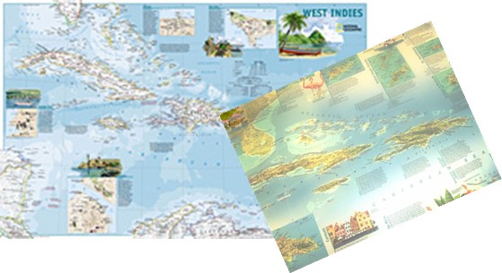
National Geographic West Indies map. 36 x 24
Explore the tropical beaches of the West Indies with our helpful two-sided map for travelers. SIDE ONE features 20 island maps along with essential travel information on topics ranging from beaches to sailing alongside beautiful watercolors of island birds, flowers, and landscapes. SIDE TWO is a political map that spans west to include all of Cuba and the entire chain of islands through Trinidad and Tobago. City insets and brief historical and tourist information for Nassau, Bahamas, San Juan, Puerto Rico, Charlotte Amalie, U.S. Virgin Islands, Havana, Cuba, and George Town, Cayman Islands make this a must-have for anyone visiting the region.