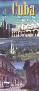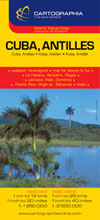
Cuba Antilles Map
Width: 11 cm Height: 24.5 cm Updated, re-designed edition! The narrow informative coverpage shows presentation of scale, website, product benefits. With exact area of map + location on continent + related products on reverse side! PRODUCT BENEFITS: Inset map of La Habana, Varadero, Playas, Jamaica, Haiti, Dominica, Puerto Rico, Virgin Is., Bahamas Map for Leisure & Fun! DETAILS: motorway, expressway, connecting road, dirt-road, distance in km, ferry, state frontier, province boundary, province seat, ferry-line, port, airport, railway, bus terminal, parking-place, post office, hotel, church,cloister, museum, monument, statue, theatre, hospital, tourist site, historical site, national park, camping site, beach, spa, angling spot, hunting range, cave, lighthouse, swamp, mangrove